UAV (Drone) Mapping
-
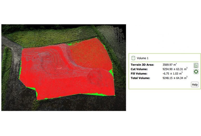 Volumetric analysis
 -
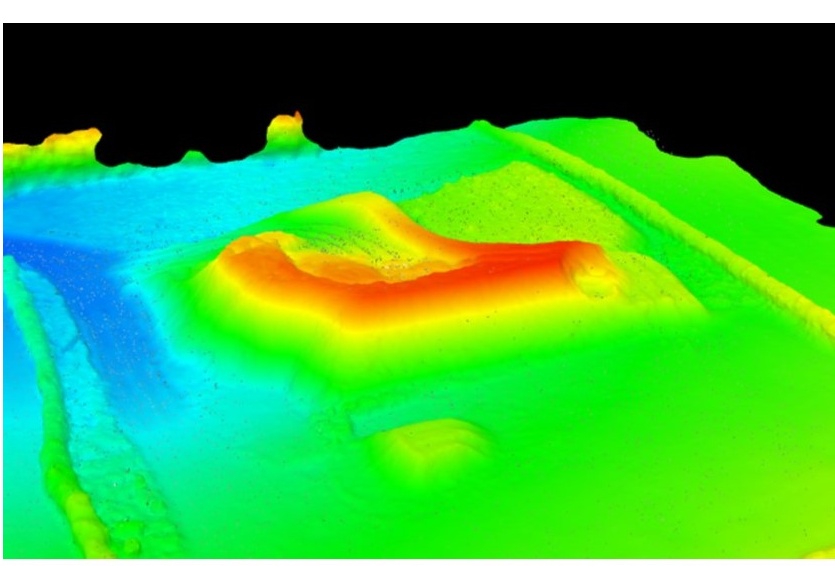 3D DTM
 -
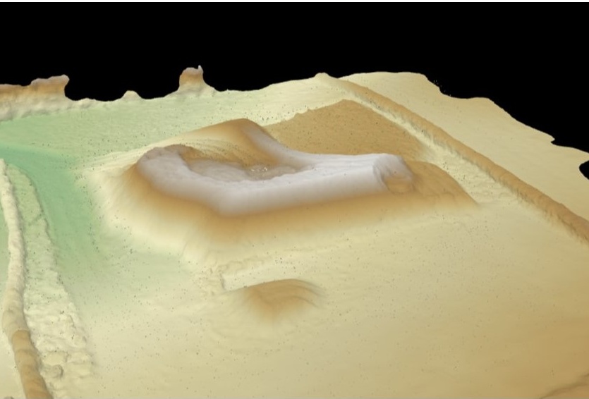 3D DTM
 -
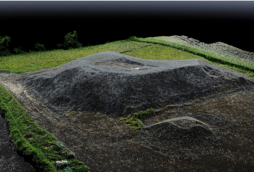 Point cloud creation
 -
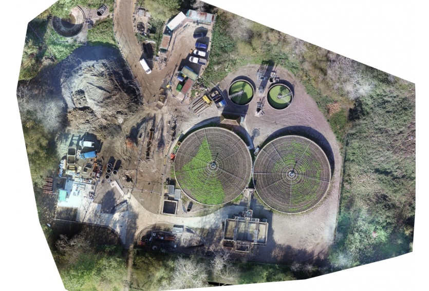
 Orthomosaic
 -
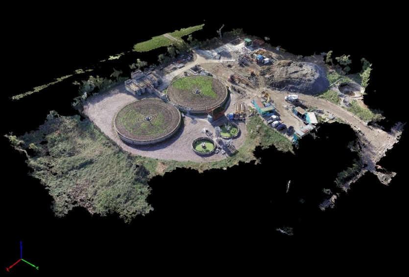 3D Model
 -
 Orthomosiac creation
CADSITE utilises latest UAV (Unmanned Aerial Vehicle) technology for aerial surveys and mapping. Through a technique called Photogrammetry, the UAV's (or drones as they are more commonly known), collect low altitude images which are stitched together and georeferenced through onboard GPS systems. Once the data is collected, photogrammetry software can create point clouds, digital surface models, 3D terrain models, orthomosaics and more.
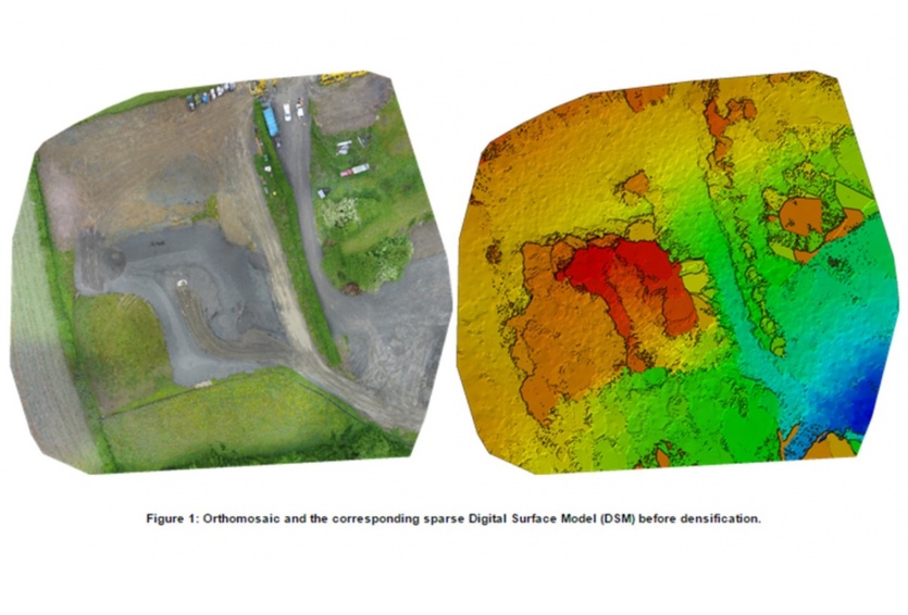
Recently, CADSITE have used drones to collect volumetric data on construction sites. Traditionally, a surveyor would have used a total station or GPS system to collect data from a stock pile, this would have involved a lot of time spent 'walking' the pile and possibly many instrument set ups. This is not only very time consuming, but can be dangerous at times too. Utilising UAV's, a drone can be deployed very quickly and stockpiles can measured (photos taken) normally in under 20 minutes. The photographs are then processed through photogrammetry software and DTM models created where volumetric analysis is carried out. This is a much quicker process than the traditional surveying technique. In terms of cost, drone mapping is very attractive to clients due to time savings over traditional techniques.
Applications of UAV mapping...
There are many applications for UAV mapping and surveying, it is expected that the list will continue to grow as enhancements in technology and research continue over time. Applications include;
- Mining- Quarry mapping, contour line creation, extration monitoring, volumetrics.
- As-builts- Creates a model of a site at a point in time, useful for site management and progression.
- Mapping- Large scale models, boundary identification, 3D models.
- Forensics- Fast data capture means less road closure time, non-invasive evidence collection, mesure directly within 3D model.
- Inspection- Thermal mapping, structural visulisation, defect location from images.
- 3D Printing- Models created can be exported to 3D printing devices. Useful for consruction sites, historical buildings, golf courses.
If CADSITE can assist with your UAV mapping and surveying needs or you would like to discuss more, please get in touch.